Cyclone Nargis
Background to the scale of the impact of Cyclone Nargis:
– Cyclone Nargis was a strong tropical cyclone that caused the worst natural disaster in the recorded history of Burma.
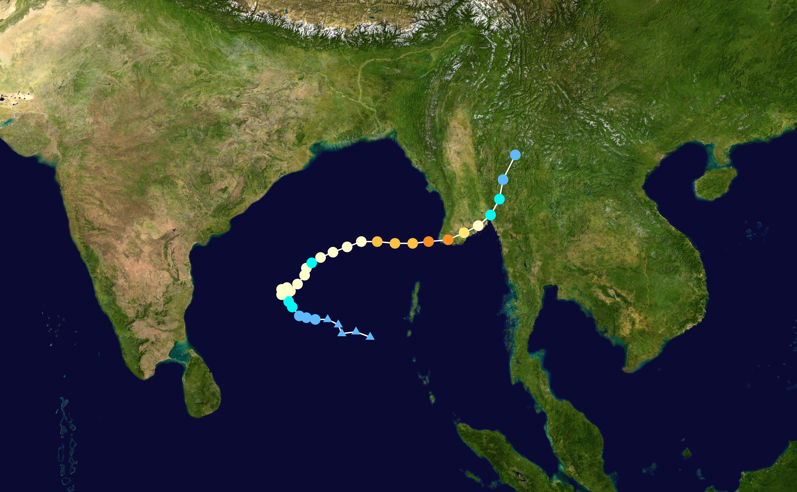
– It began as an intense tropical depression on April 27th 2008 in the Bay of Bengal.
– Meteorologists initially thought that the storm would track over Bangladesh
– However, the storm changed direction and headed towards Burma, where it made land over the Irrawaddy delta in the south of the country on May 2nd.
– It had intensified into a category 3/4 storm on the Simpson–Saffir scale
– 215 km/hr winds
– In some places 600mm of rain fell
– 146000 people were killed, or reported missing
– $10 million damage occurred
– 75% of hospitals and clinics were badly destroyed or damaged
– Diarrhoea, dysentery and skin infections afflicted the survivors who were crammed into monasteries, schools and other buildings after arriving in towns already under pressure before the cyclone.
Human Factors
– Burma has a very low level of development
– Low levels of education
– 39% never enrol in primary education; there has also been a decline in spending in education.
– Burma’s military government (referred to as a junta) declined international aid for several days, in attempts to try and handle the situation on there own.
– On May 6th they accepted aid only from specific countries such as India and Bangladesh, yet only for restricted items and it was not until 10 days later that 50 Indian medical workers were accepted.
– Many other nations and non-governmental organisations (NGOs) hoping to deliver relief were unable to do so.
– The World Food Programme (WFP) stated that the delays were ‘unprecedented in modern humanitarian relief efforts’.
– More than two weeks after the storm, relief had only reached 25% of the population.
– Many Burmese people were displeased with the government as they had not provided an appropriate warning system for the cyclone, despite having been informed by Indian meteorologists 48 hours prior to its arrival.
– More than two weeks after the storm, relief had only reached 25% of the population
– It was the Burmese government’s response – or lack of it – that caused widespread disbelief and condemnation around the world.
Physical Factors
– Burma lies between the Tropic of Cancer and the Equator. It’s in the monsoon region of Asia, with its coastal regions receiving over 5,000 mm (196.9 in) of rain annually.
– Annual rainfall in the delta region is approximately 2,500 mm (98.4 in), while average annual rainfall in the Dry Zone, which is located in central Burma, is less than 1,000 mm (39.4 in).
– The Irrawaddy delta in Burma was the worst hit area. The delta contains 7 million of the country’s 53 million people, with nearly 2 million of these living on land that is less than 5m above sea level, ithas a population density of 100/km2, leaving them extremely vulnerable. Some towns lost 90% of their homes, with 70% of their population dead or missing.
– The agricultural land is very fertile, being regarded as the nation’s ‘rice bowl’, and hence any damage to it would affect the whole country.
– 10,000 people had been killed by the sea surge due to its coastal area.
– Labutta, a small town in the south west of the delta region was devastated with 50% of houses being destroyed.